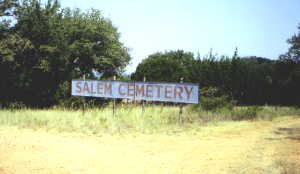
Salem Cemetery
 Located 11 miles west of Brownwood on US 67, turn right (north) at Cemetery
sign. This is CR-140, continue on this road about three miles to
a "Y" intersection and drive to the top of the hill. Turn cast, (right),
on CR-139
Located 11 miles west of Brownwood on US 67, turn right (north) at Cemetery
sign. This is CR-140, continue on this road about three miles to
a "Y" intersection and drive to the top of the hill. Turn cast, (right),
on CR-139
The Cemetery is on the left.
It was surveyed on March 14, 1971, double-checked and up-dated February
20, 1980 by Mr. and Mrs. E. T. Wetzel. Georgia Rodgers surveyed this
cemetery on August 27, 2000.
Return to Cemeteries
Home Page
Return to Brown County Historical
Commission Home Page
Return to Brown County
History Home Page